We returned to a smoky Sydney today, the worst we’ve seen on turnaround days. I feel so badly about these bush fires; Australia is burning, and the impact is tragic. We smelled smoke in our inside cabin as soon as the ship entered Sydney Harbour, so we knew how the day would go. Still, we decided to do the coastal walk we had put off last turnaround day. We just can’t count on ever having a clear day here this season.
We were at breakfast in the DaVinci Dining Room as soon as it opened at 6:30am, and by 8:30am were walking off the ship with our usual collection of cash and passports and credit, ATM and Opal cards. We knew it was going to be HOT today, and thought an early start was wise.
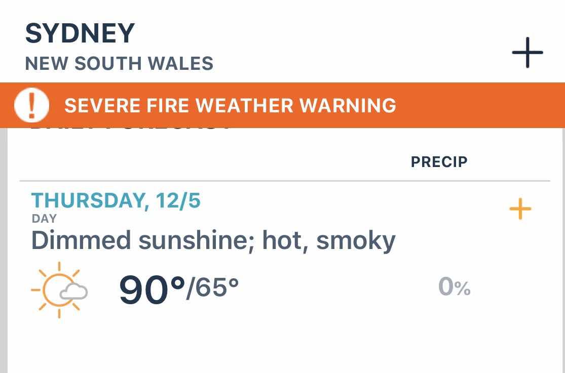
Hot, dry and windy
The conditions couldn’t be worse for fire containment

We were happy to see that The Rocks area next to the Overseas Passenger Terminal will be
We were happy to see that The Rocks area next to the Overseas Passenger Terminal will be
home to Christmas Markets starting today. We’ll check it out next turnaround day (a Friday)
We caught a ferry from Circular Quay to Watson’s Bay, on the eastern end of the south side of Sydney Harbour. This is where we went with Paul and Marlene and had fish and chips at Doyle’s on the Wharf. Today we left the wharf and headed further east right along the waterfront.

It was smoky this morning when we left, but not nearly as bad as it was later in the day.
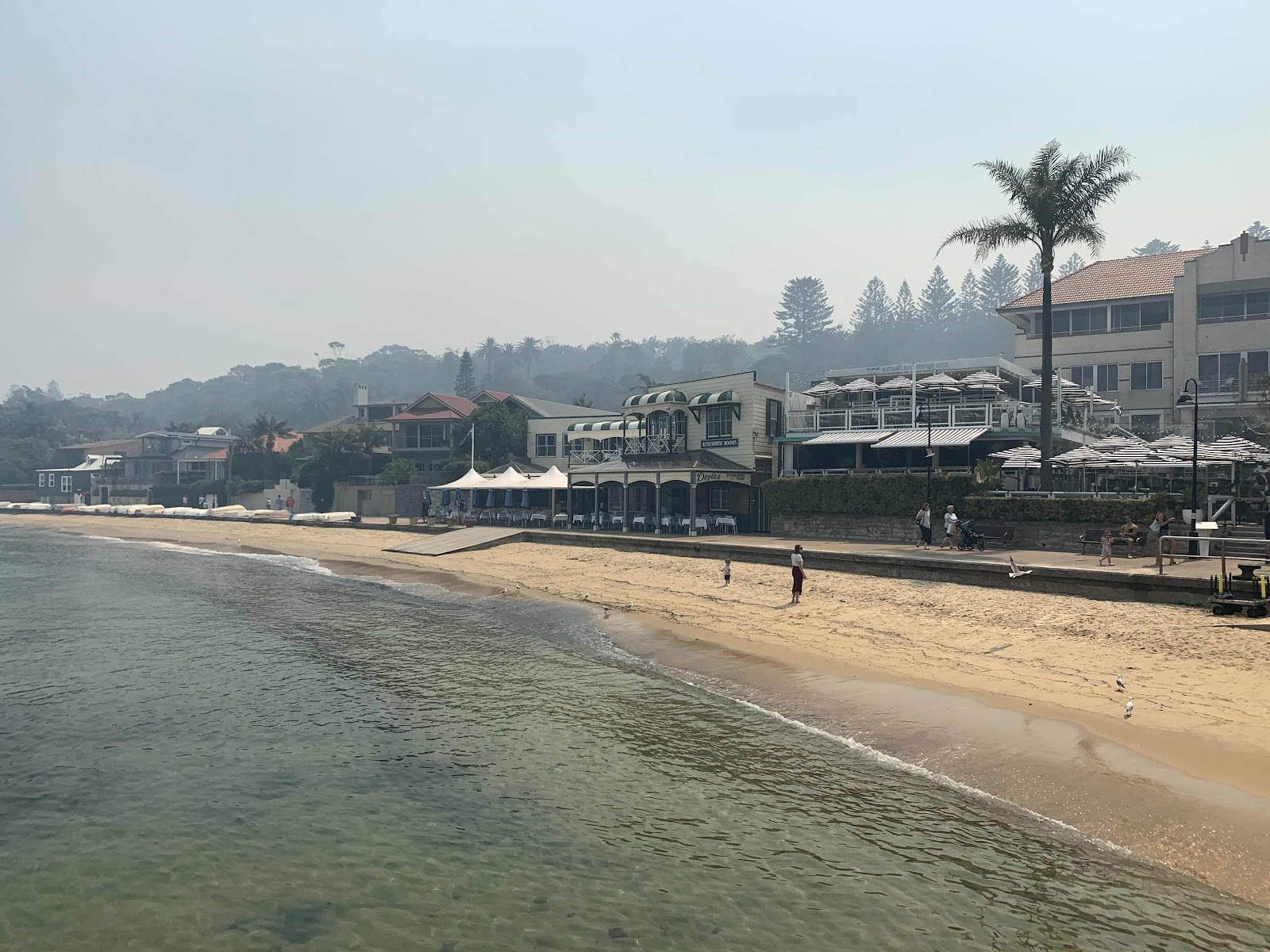
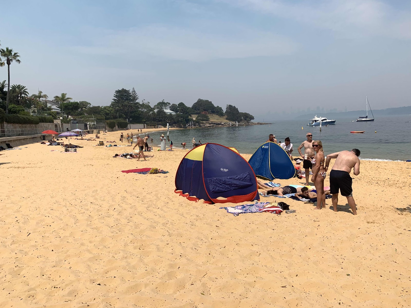
Watson’s Bay Beach
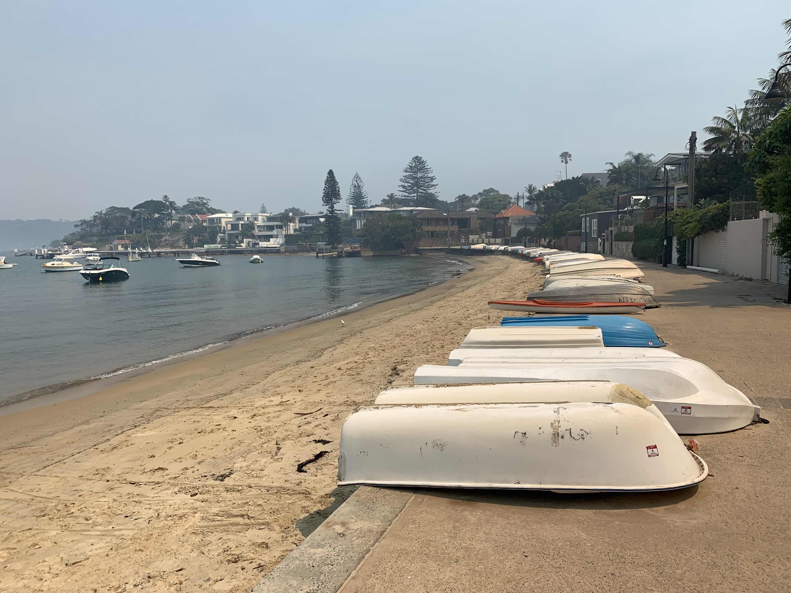
Boats, primarily tenders to the boats anchored in Watson’s Bay
We then turned inland a block and walked up a street that was home to small, tightly packed, older bungalows. Nearly every property was in the process of being renovated or razed for a new home to be built. The property values here are astronomical and the value is in the land. At the end of that street was Camp Cove. The cove was an important location to the Cadigal (Gadigal) people who gathered fresh water, shellfish, launched their canoes and buried some of their people nearby. This cove is also believed to be the first landing place for Europeans in 1788. The name Camp Cove was given during that landing and appears on the earliest maps of Sydney Harbour.
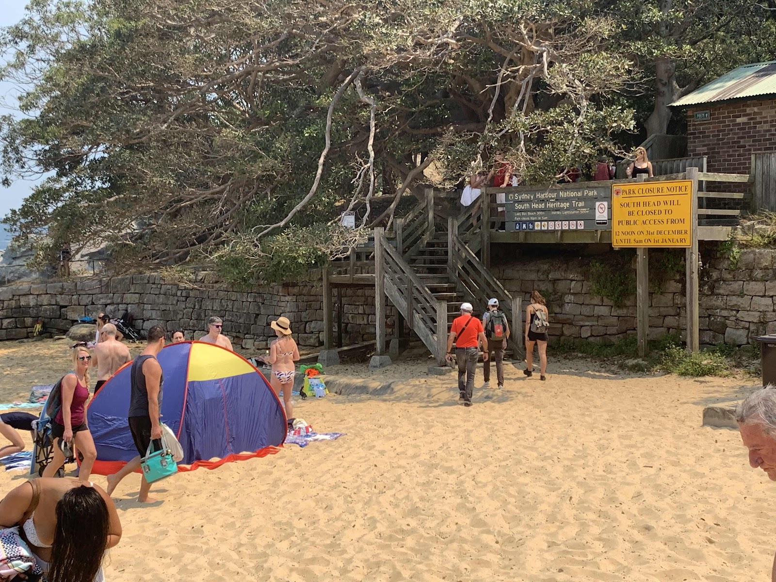
The trailhead for the South Head Heritage Trail starts on the east side of Camp Cove
Camp Cove Beach

Trailhead
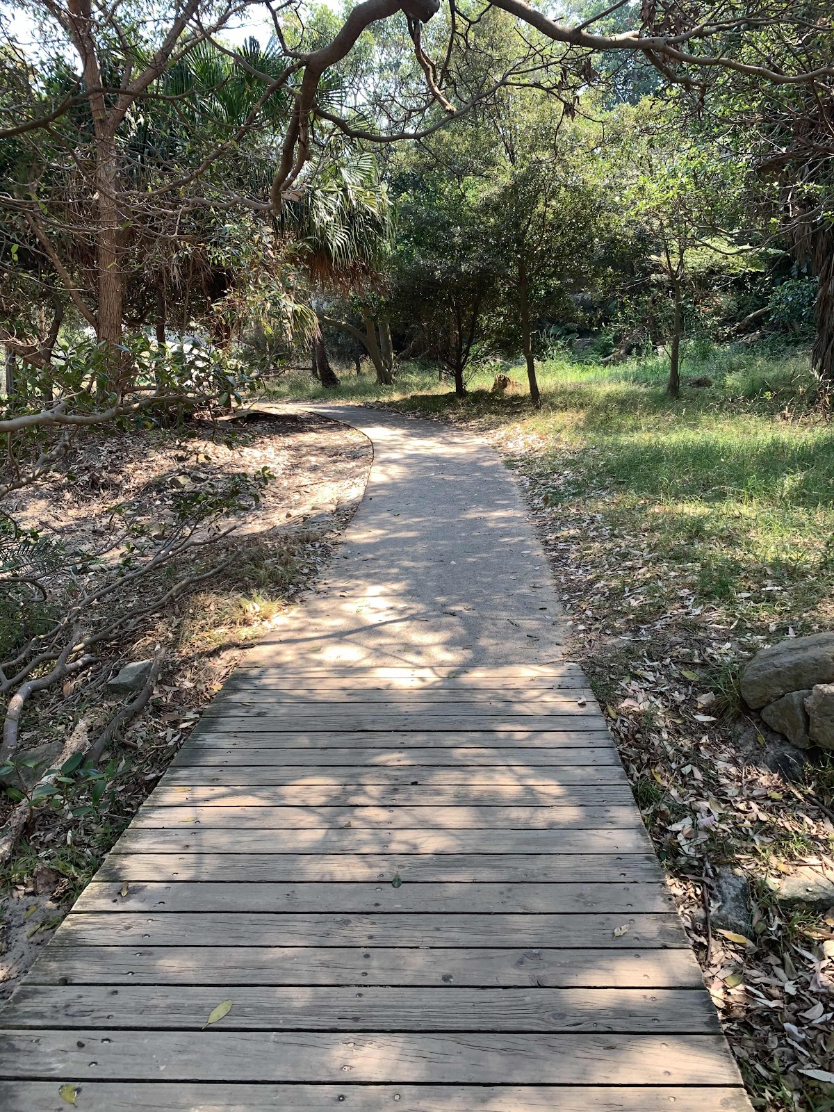
The trail was alternately boardwalk, cobblestone and dirt
and immediately entered a treed area (blissful shade)
Looking back toward Camp Cove
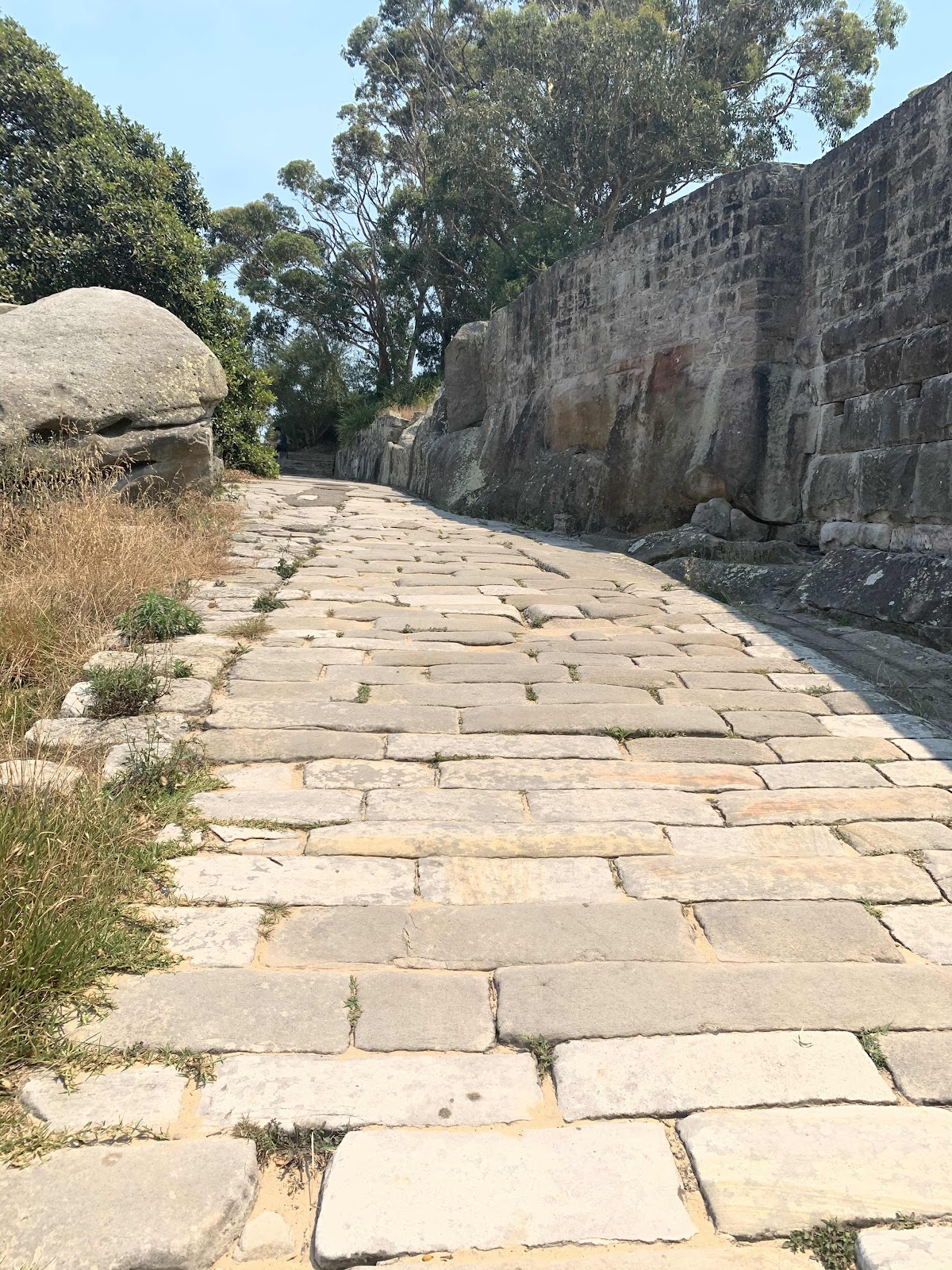
The cannon (below) was placed here prior to 1890, along with the rest of the gun emplacement and rifle walls. The emplacement was designed to protect a military jetty and boat shed from the threat of an invasion. The 'Cobblestone Road' beside the cannon was built during the late 1870s or early 1880s and extends from the jetty in Camp Cove up to Hornby Road above. The road was built to carry supplies and ordnance from Camp Cove to the various military installations on South Head.

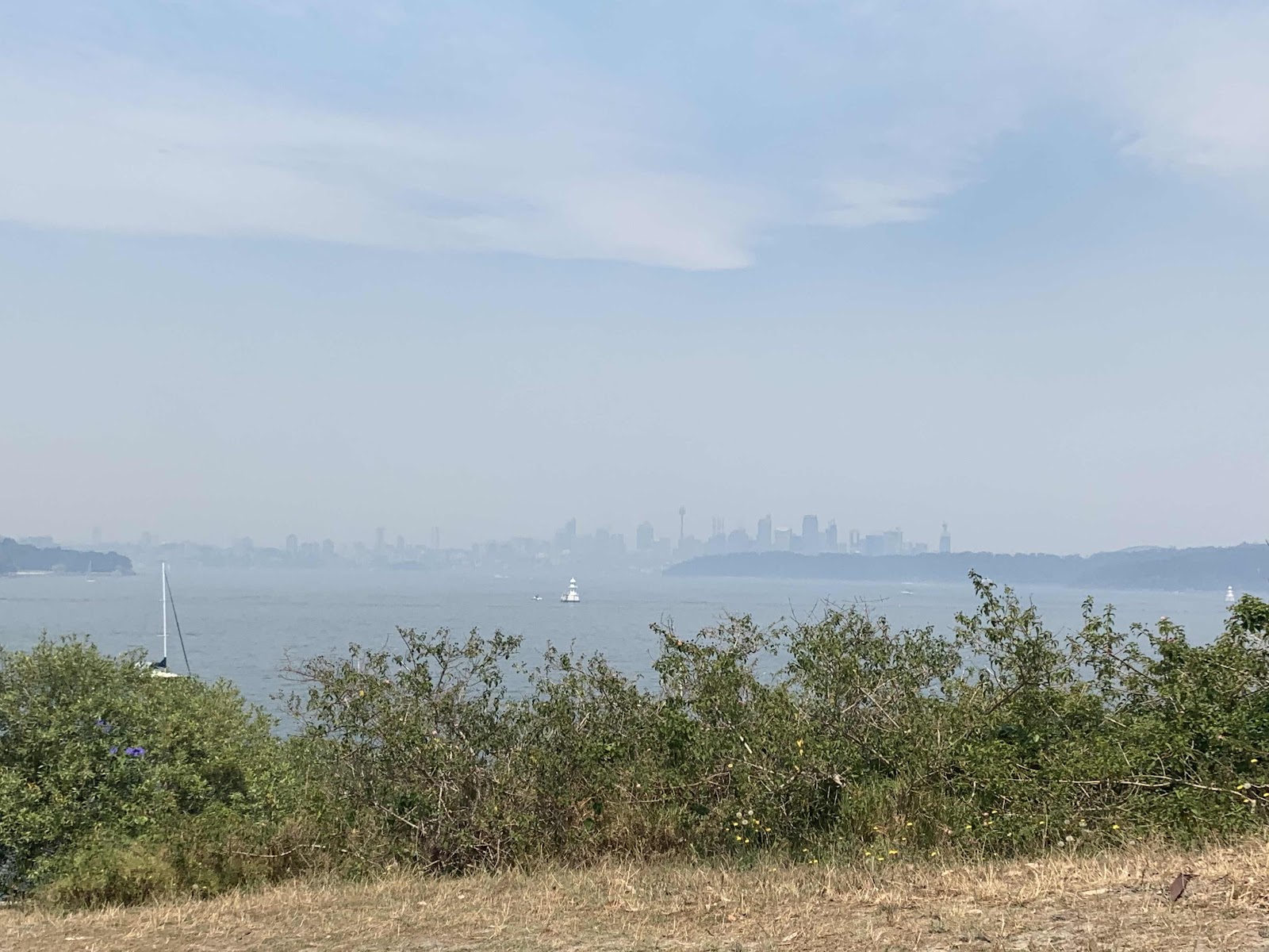
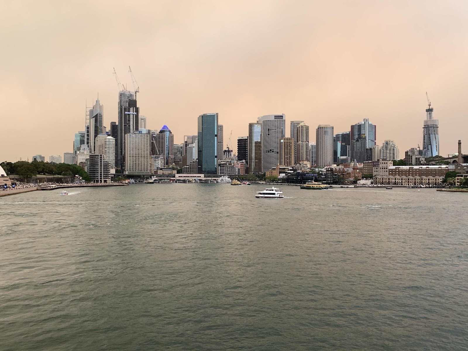
The Sydney skyline was barely visible through the smoke
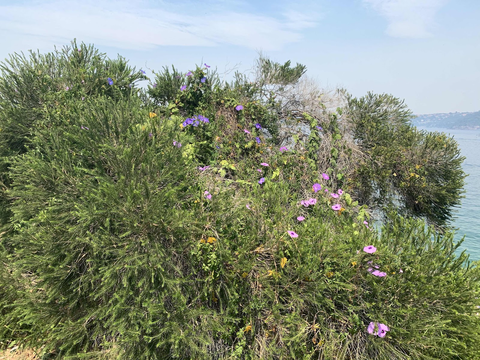
Spring blooming wild shrubs
We soon reached Lady Bay Beach, a nudist beach found on the inside of South Head. Officially declared a nude bathing beach by Neville Wran in 1976, nudity is only permitted on the beach and water, but is not required to use the beach. We stopped here on our return (oh yes we did!) to cool off from hiking in the heat.

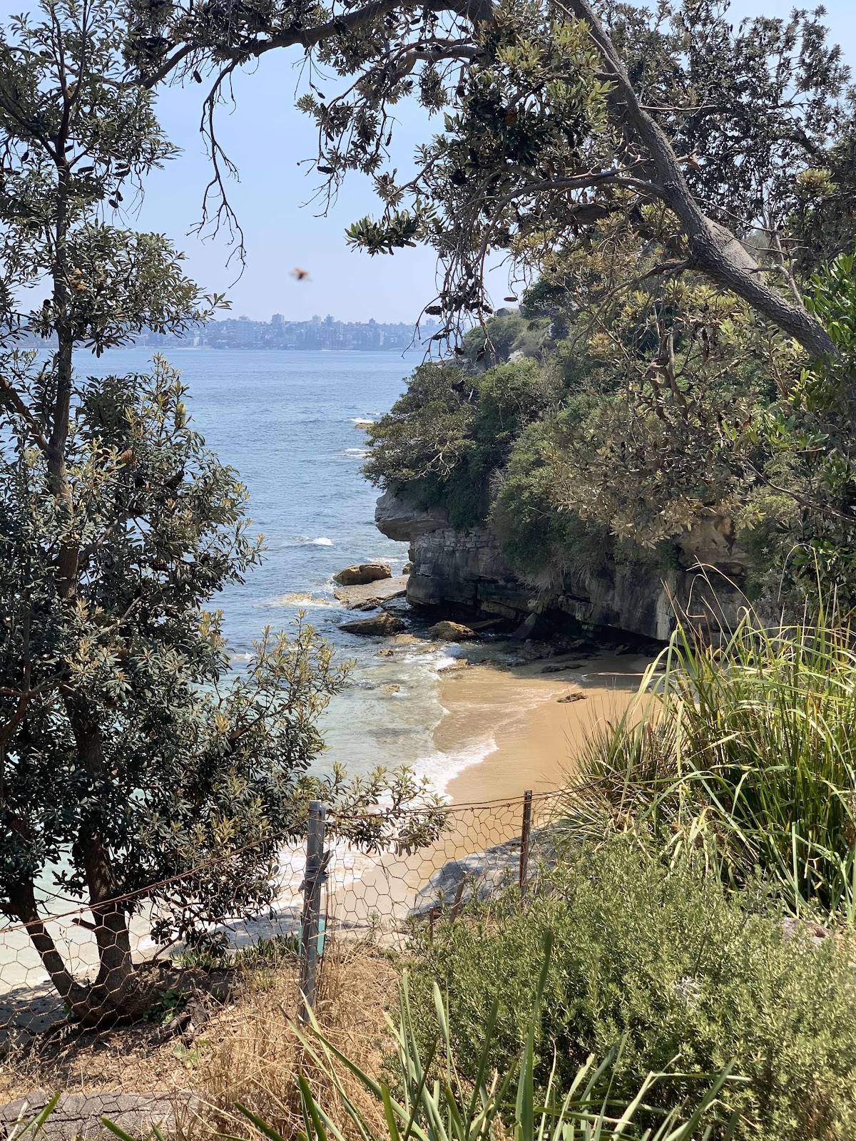
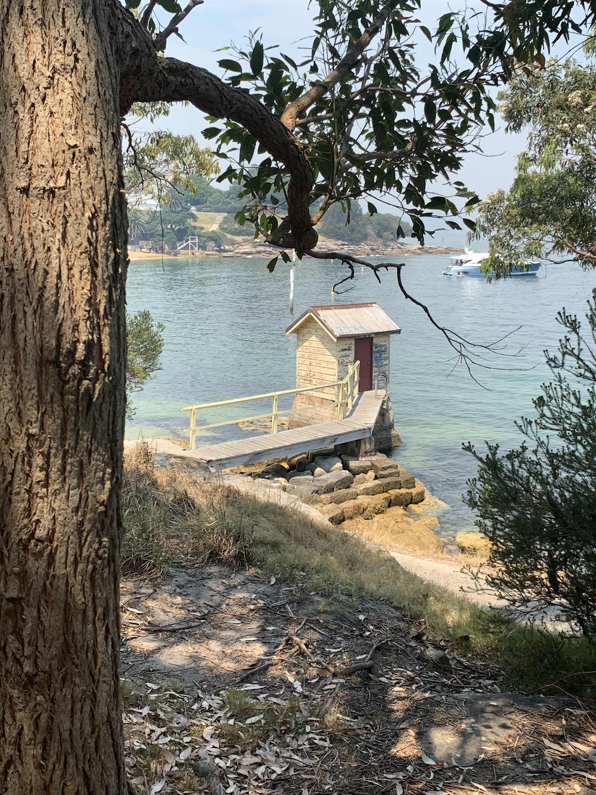
A view of Lady Bay Beach from the trail

The flowers on this shrub were spectacular
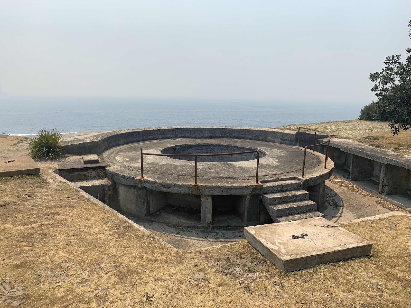
Gun emplacements like those shown below were built up and down the coast, and around the shores of Sydney Harbour. The first emplacement, built in 1788, was designed as a signalling station to notify the arrival of a ship. Then in 1839, the undetected arrival of ships, from the fast developing USA, caused a great concern. This triggered the building of the well-known fortifications at Bradleys Head and Fort Denison, as well as these ones at South Head. Another enemy at the time, France, then joined a campaign against a newer enemy - the Russians - in 1853, which prompted the completion of these gun emplacements. Guns were installed in 1872. In WWII, it was the Japanese enemy who these guns were trying to keep out, then in 1944, when the threat of invasion was less of a concern, the emplacements were disarmed.

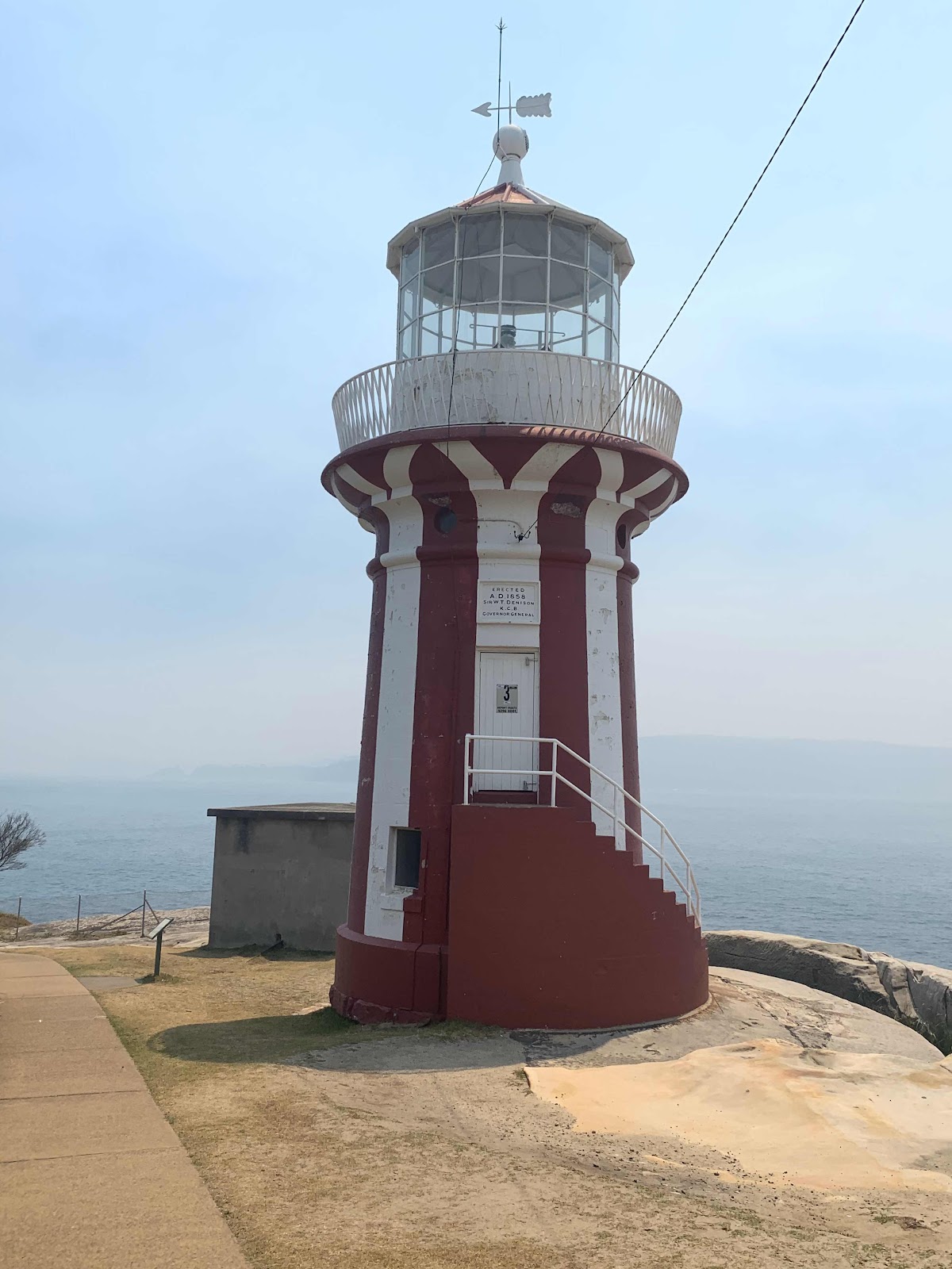
The head lighthouse keeper’s cottage was completed around 1860. The first head lighthouse keeper was the well-motivated James Johnston, who was aboard the Dubar (a sailing ship on route from England) that smashed against the rocks near The Gap (a rock cliff area we later hiked to) in 1857. 121 souls were lost that evening and James Johnston was the only survivor.
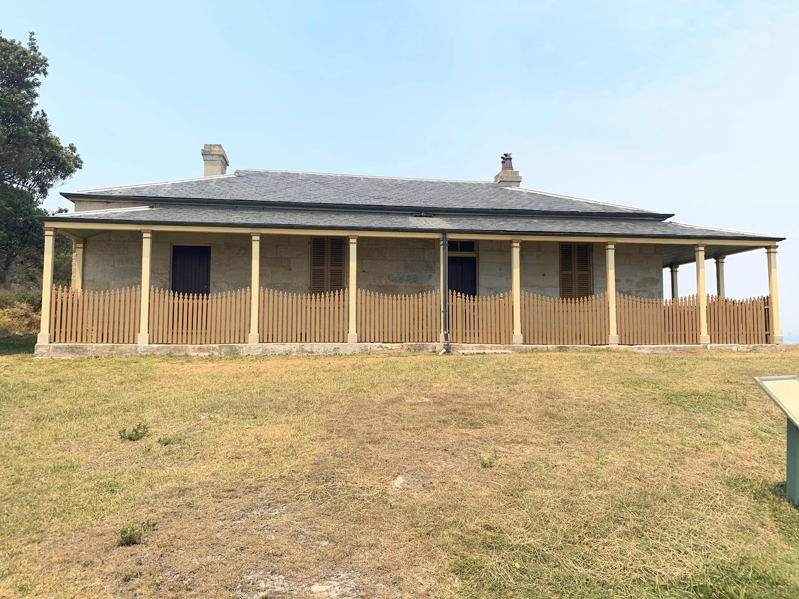
The head lighthouse keeper’s cottage
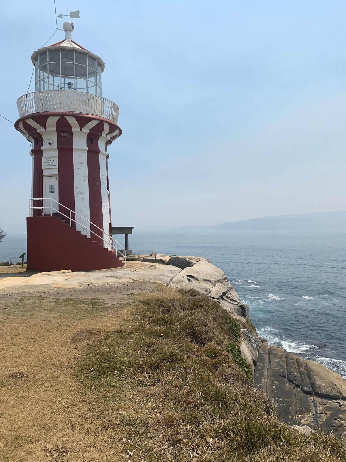
The Hornby Lighthouse was opened by Sir William Denison (then Governor of New South Wales) in 1858. This distinct red and white vertical striped lighthouse was originally powered by a high-tech kerosene lantern. The lighthouse was built in response to two significant losses of life near South Head - first in 1857, the 'Dubar' (on its last leg from England), when 121 of the 122 people on board lost their lives, and soon after, the 'Catherine Adamson' when 21 lives were lost near North Head just two months later. Since 1933, this lighthouse has been automated and is now powered with a 12 volt, 55 watt Quartz Halogen Lamp.
Hornby Lighthouse
The cliffs at the South Head
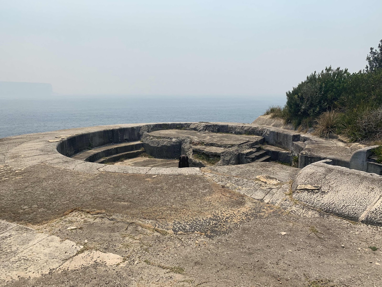
More gun emplacements

I think this is called an allium
The trail was a loop and on our return we stopped at Lady Bay Beach. We like that there were large boulders that ran right into the water. We could sit in them and take off our shoes and socks, and then allow our feet to dry and put our shoes back in without walking through the sand. While we were there, a small boat came up to the beach, and rang a bell. This was the cue for all these nekked people to line up to buy ice cream. It was an ice cream boat that went from beach to beach selling ice cream novelties.
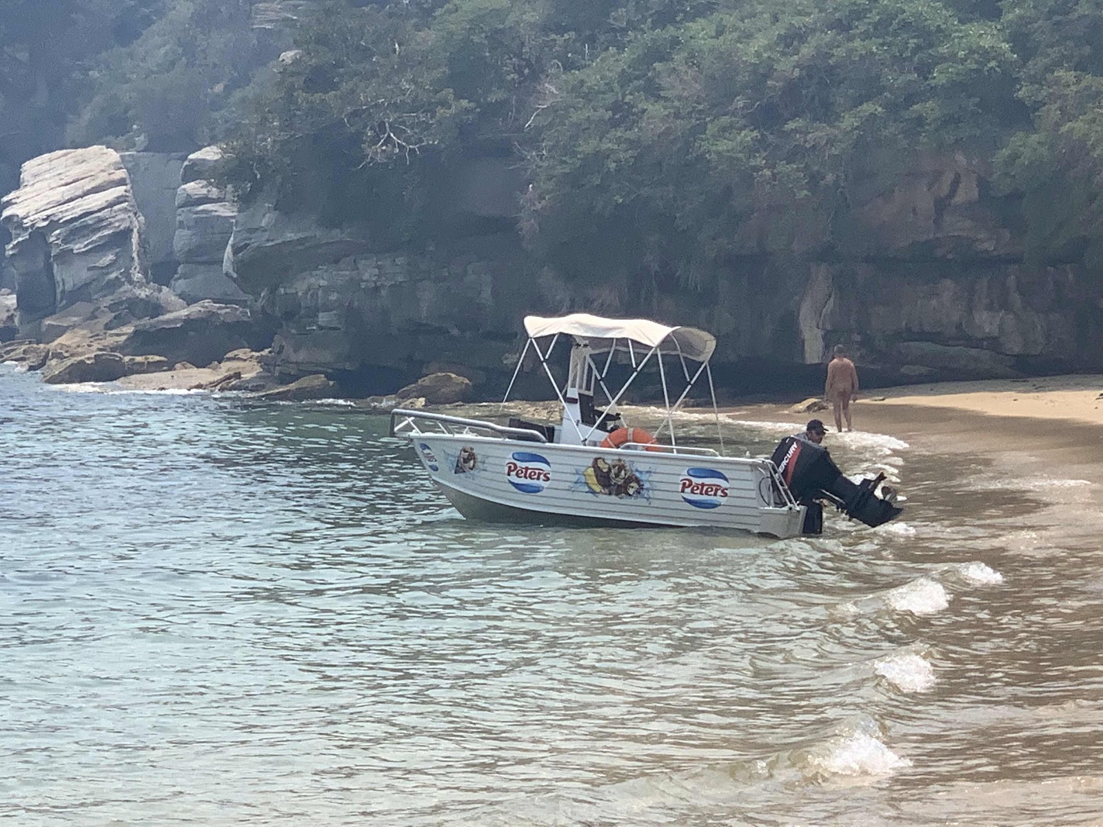
The ice cream boat
Once back at Watson’s Bay, we took a few minutes to detour across the narrow strip of land to Gap Bluff. This is actually on the ocean side and is the sad site of several suicides as people leaped to their deaths on the rocks below. Now there are two emergency phones for people to reach out for help.
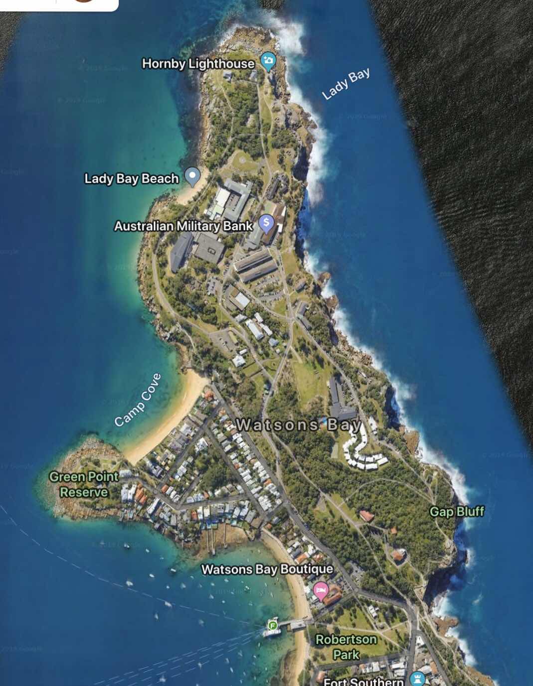
Map of our hike today

Gap Bluff
We stopped for fish and chips at Doyle’s on the Wharf (said to be the best in Sydney). Around 2:30pm we boarded a return ferry to Circular Quay, and it was immediately obvious that the smoke had worsened considerably while we were hiking. Our eyes and my lungs were burning. It was so smoky that, from the ferry in the center of the harbor we could not see either side. Visibility was only a few hundred feet.
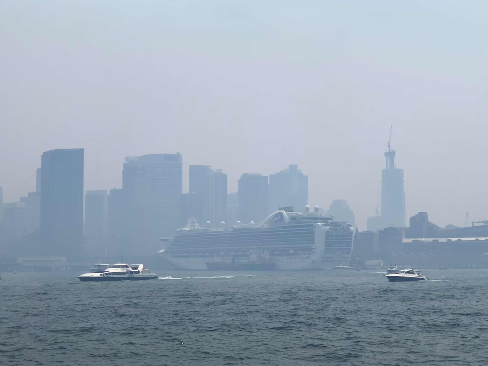
The Ruby Princess in the smoke at the Overseas Passenger Terminal
We showered and went down to the Piazza during muster drill to take some photos of the Christmas decorations with no one in them, which I’ll post tomorrow.

Day 1 dinner menu, page 1
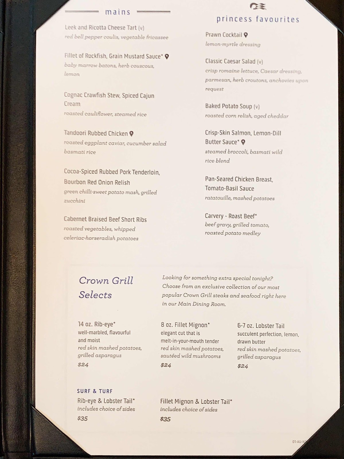
Day 1 dinner menu, page 2
Sail away didn’t take place until 7pm, and we were finished with dinner and watched from the Promenade Deck as the Ruby Princess backed out of Circular Quay and sailed through Sydney Harbour. The smoke had again cleared a little and sail away was surprisingly pretty.


Camp Cove Beach

Hornby Lighthouse and the head lighthouse keeper’s cottage
By 7:45pm the Ruby Princess was in the open Coral Sea and we went to the Princess Theater to watch production show Once Upon a Dream. We really went just to hear Cruise Director Aaron share the top passenger nationalities on board this cruise. Well, shocker, the US didn’t even make the top four. There are fewer than 38 US passengers on this cruise...and over 300 kids. It’s good practice for the next cruise, which will have 700 kids on board. I predict that I’ll need more than a little closet time to be able to cope.
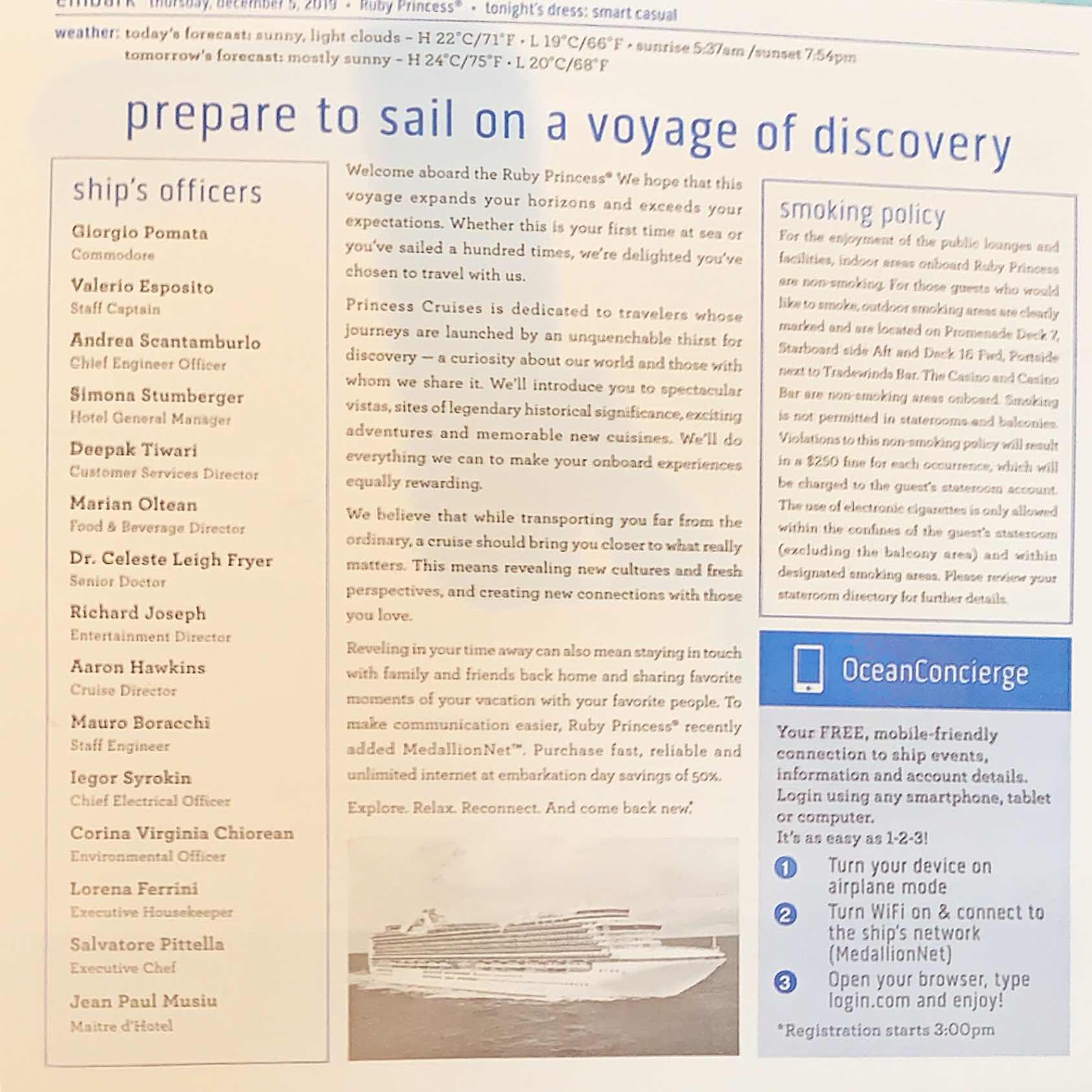
Day 1 Princess Patter, page 1

Day 1 Princess Patter, page 2
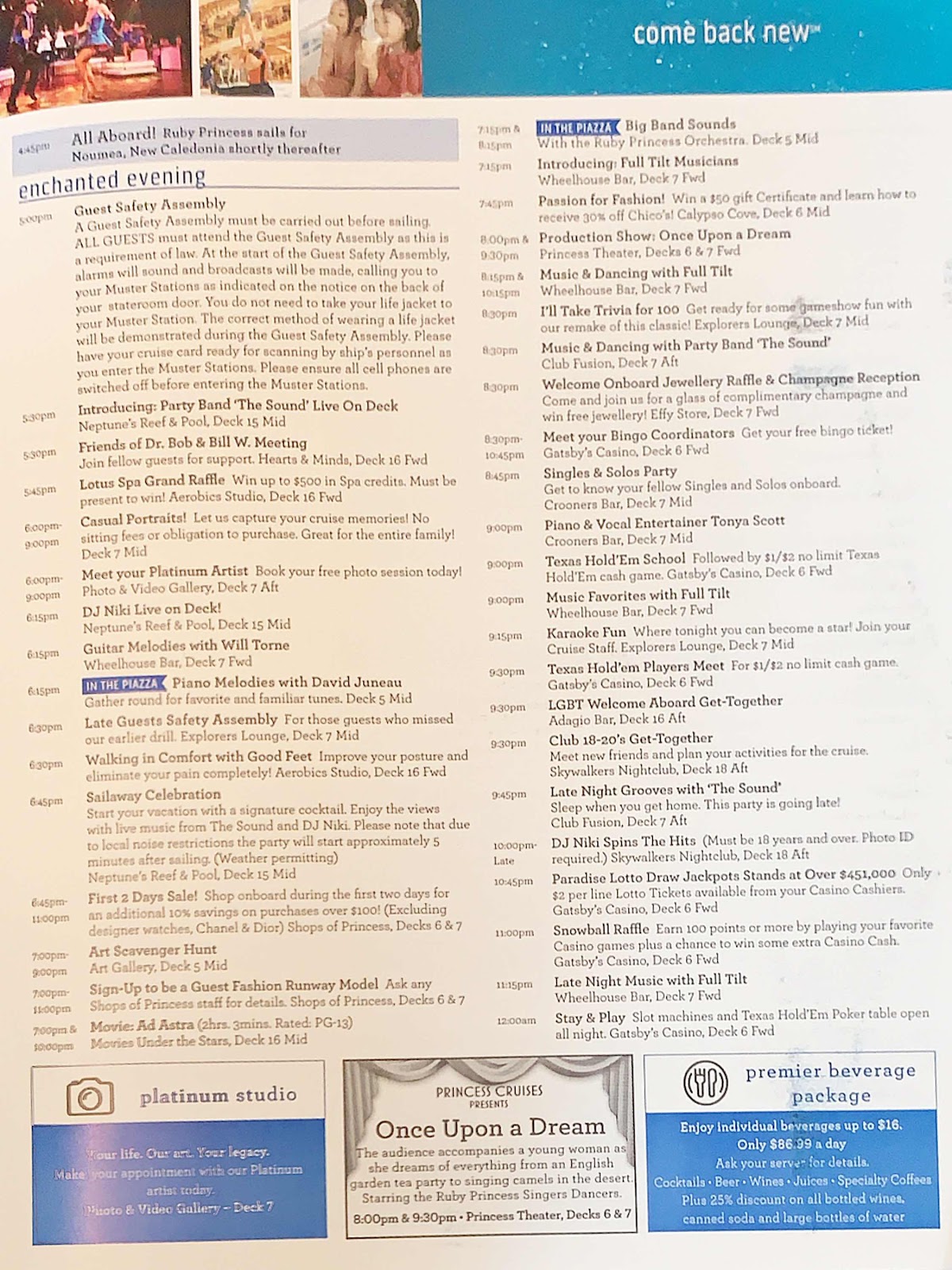
Day 1 Princess Patter, page 3

Day 1 Princess Patter, page 4