Showing posts with label Eleuthera. Show all posts
Showing posts with label Eleuthera. Show all posts
Saturday, January 18, 2014
Thursday, January 17, 2013
Princess Cays- Part 3


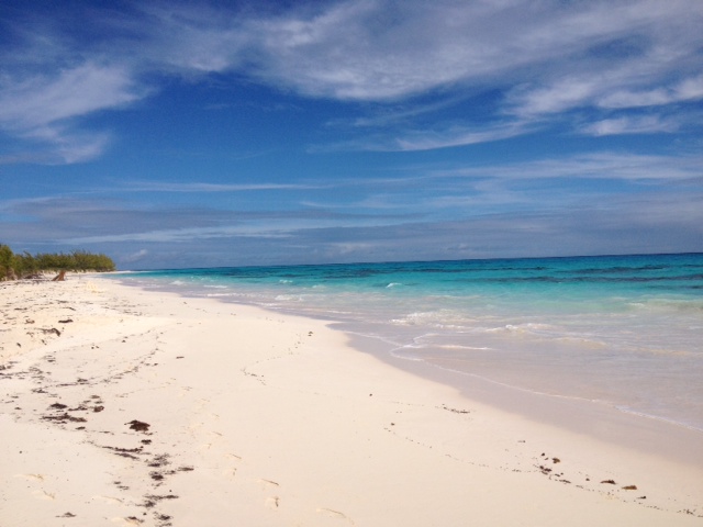

Photo 3: the lighthouse perched above the cliffs
Photo 4: the long stretch of the Atlantic side of Lighthouse Beach
Photo 5: I could watch the sea sprays forever


Princess Cays- part 2


Photo 2: check out that water color!
Photo 3: walking on the sand dune around the back side of the rock the lighthouse is on, to get to the Atlantic side
Photos 4 and 5: the carved coral cliffs and palm trees make it look very Jurassic Park-y
Day 72: Princess Cays


We had a good sleep last night, and I awoke completely pain-free in my #13 tooth. Yay! Having that behind me, and having my new iPhone, I'm feeling really settled and comfortable in a way that I haven't since that tooth first started bothering me, just before Christmas. I feel really good going into the last bit of our winter at sea. (Knocking on wood).
We didn't move our clocks ahead an hour last night. Doing this itinerary in this direction, we won't move an hour ahead until tonight. The Bahamas are on EST; it's just when Princess Cays is our final port of a cruise that the ship is on AST though the port is on EST. Most people never leave the Princess Cays area, and so aren't even aware that the local time and ship's time don't match. Most people...
Yes, after a hearty breakfast in the dining room, we packed my backpack for another hike down to the lighthouse on the southern tip of the island of Eleuthera. I left this decision up to G, and at first he waffled a bit about the 8 mile hike, but, in the end, he thought we really needed to do it. His eight daily scoops of ice cream are catching up with him. Not only do we get a bit of a workout when we do this hike, we also skip lunch altogether, not a bad thing at this point.
So we found ourselves on a very early tender and again left a note with the Medical Center at Princess Cays letting them know who we are and where we went for the day. I guess it's kind of the equivalent of signing a register at a trailhead: in case we end up missing, here's where to look first.
We were almost an hour ahead of the last time we did this, on December 26th, and left the Princess Cays area at 9:45am. It was already hot and sunny at that time, but if that was any indication of what our walk back in the early afternoon would be, we chose to ignore it. As always, it took 15 minutes to walk from the Princess Cays area to our first turn off, then 15 minutes further took us to the southbound "road". And that's when we really started to feel the heat of the sun. What we can usually do in 35 minutes took us 45 minutes today, as we carefully picked our way down that horribly pitted road. We could hear the wind and the waves before we could see them; our first sighting of the palm trees that line the beach area propelled us through the last bit of the walk.
The beach on the Caribbean side was empty today; in fact, we didn't see another person the entire five hours we were away from Princess Cays. We walked to the beach on the Atlantic side over the sand dunes, and, once we arrived (it was close to 11:30am by that time), sat down right on the sand, drinking our water and eating the protein bars we'd packed. The wind was blowing so hard and the waves were so big that if we were more than 10 feet apart, we couldn't hear each other even if we yelled.
Finally, I decided to walk down the entire length of the beach, to see what lay beyond where the beach curved out of sight. The sand on these two beaches is perfect powdered sugar sand, just as there is on Holland America's private island resort, Half Moon Cay. That's not surprising; Half Moon Cay is only about 15 miles south of Princess Cays, and I could see two cruise ships anchored in the distance, no doubt the ships at Half Moon Cay today. Walking on that sand was just like walking on snow; I'd walk on top of the sand and then occasionally break through up to my ankles, then be back on top of it again. That walk alone was a workout.
Beyond that curve, there was simply more beach as far as I could see. More beach and still no people...this is one isolated place!
At 12:30pm we climbed the rock cliffs up to the now-familiar lighthouse, and then made our way down to the beach on the Caribbean side. We walked the length of this until 1:30pm when we climbed back up the dunes and began our walk back to Princess Cays.
As soon as we started back, I became aware of how hot it was away from the cooling ocean winds, and how unrelenting the sun was. And how tired I was after walking all that way on the beaches. And how warm our remaining water was. A walk that we can do in 65 minutes took us nearly 90 to complete, and it was just before 3pm when we checked in at the Medical Center on Princess Cays to report that we had returned home safely.
I nearly fell asleep on the tender back to the Emerald Princess, and once on board, we fell into our now-familiar roles: G went to a hot tub and I washed out our water bottles and rinsed out the nylon shorts I'd worn.
I showered before G returned to the cabin, trying to psyche myself up for the evening ahead. For some reason, we had received an invitation to the Gold Captains Circle members party, which took place in the Princess Theater at 4:45pm. Never ones to pass up a party, we went, and enjoyed the Emerald Princess orchestra's live music and the singers performing a jazzy rendition of the Love Boat theme.
By the time the party/presentation had ended, the dining room doors were open and we were anxious to eat. We. Were. Starving. I had a pineapple and prickly pear starter, then a salad, then TWO entrees (salmon and a seafood skewer) and my usual broccoli and spinach. I had to skip dessert...I was full after all that food, and once again marveled at how it's possible to go from being so hungry to so full in the course of an hour.
As tired as we were, we forced ourselves to go to the 7:15pm performance of comedian Al Katz. We'd seen him before, but not this winter, and we enjoyed him a lot. There was no show in the Explorers Lounge tonight, and though we caught a few minutes of juggler Aaron Bonk in the Piazza, we decided to skip listening to band Sole Provider tonight and just head back to the cabin.
G was asleep in five minutes, and I will be too, soon after sending this post.
After visiting Princess Cays twice in three days, and a busy turnaround day in Fort Lauderdale, we are so READY for a day at sea!
Photo 1: the "well" at the entrance to Princess Cays from the road
Photos 2 and 3: the "roads" we take to the southern end of Eleuthera
Photo 4: Mr. Crabby, a hermit crab, was crossing the road carrying this shell on his back when we happened by
Photo 5: finally, our first view of this line of palm trees indicated we were getting close to the Caribbean beach
Wednesday, December 26, 2012
The Atlantic beach


Photo 2: one of the caves carved by the ocean
Photo 3: the lighthouse sitting up on the cliff
Photo 4: going back the easy way, across the sand dune
Photo 5: on the Caribbean side, a couple of benches have been constructed. It's getting developed!
Final hike to the southernmost point

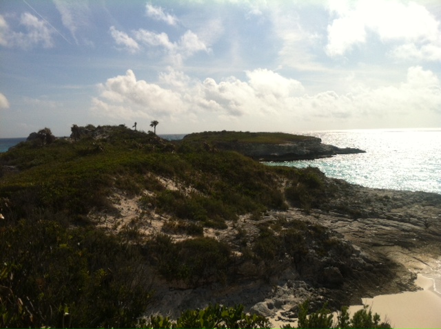


Photo 2: we were heading out to that palm tree on the end of the main island
Photo 3: the path through the brush (it was scratchy too!)
Photo 4: standing high on the southern tip of Eleuthera
Photo 5: our first view of the beach on the Atlantic side
Photo 6: looking back toward the lighthouse
The southern lighthouse on Eleuthera


The Caribbean side of the southern end of Eleuthera


Photo 2: to get to the lighthouse, walk across this coral on the southern end of the Caribbean beach
Photo 3: another view of the beach
Photo 4: look for this path in the shrub growth
Photo 5: watch for roots under the palm leaves on the ground and pick up your feet!
Almost to the southern end of Eleuthera


Photo 2: the brackish pond
Photo 3: the sign for the freshwater pond
Photo 4: the freshwater pond
Photo 5: our first view of the Caribbean beach
Walk to the southern end of Eleuthera


Photos 2 and 3: this road is rough going in spots. There is the sound of scurrying in the trees. If we stopped, it stopped. It was disconcerting last year until we figured out it was crabs walking across the decomposing leaves on the ground.
Photo 4: just after turning right on the road that runs for about 1.5 miles to the southern end of Eleuthera, this sign appeared
Photo 5: this road is slightly better than the middle road, at least in spots.
Day 50: Princess Cays


After breakfast in the dining room, we gathered up our things and packed them in my backpack. First and foremost is water; we packed two for each of us and then filled in any empty spots with more when we were done packing. Beyond that, we took the tarp, one beach towel, sunscreen, two Pure Protein bars and I hooked my Teva sandals on to the outside of the pack. We wore our Tilley hats, and I carried my walking stick (the collapsible one, not the trekking poles that don't collapse). The walking stick proved really helpful when walking across the rough spots in the roads and also climbing out to the very southern tip and then down to the Atlantic beach.
We tendered over to the island and left the Princess Cays area at 10:37am. Just as we remembered from last year, it took us about 15 minutes to get to the turn off left off the paved road, another 15 minutes on a pretty rough road, and then we turned right for about a 35 minute walk to the beach on the Caribbean side. We've figured it's about 3 to 3.5 miles to get that far.
New this year are three signs; one just after the right turn onto the road that heads to the southern point announces Lighthouse Beach. Two others are by the large ponds close to the end of the island, and list the birds in the area.
It seems the area is being discovered!
We had been passed by three cars, people staying about 50 miles north on the island who rented 4-wheel drive SUVs for the day to drive down. Eleuthera is about 100 miles long and 1 mile wide, and there is almost nothing in the area around Princess Cays.
We decided to immediately climb up to the lighthouse, and then explored the rocks as far south as we could. There are a few small rocks/islands beyond that one that aren't connected to the Eleuthera, but we went as far as we could. We then climbed down some rocks onto the Atlantic side of the beach, and here we saw the people we had met on the way down, snorkeling and exploring the coral caves on the Atlantic side. Still, 8 people total on a long stretch of beach is pretty good, and we sat there for awhile and ate our protein bars and drank some water.
Finally, we walked back to the Caribbean side a different way, on a sand dune that wraps around the back side of the lighthouse. We allowed ourselves 75 minutes to make the 60 minute walk back, and we needed every bit of that, as it was getting pretty hot and the sun was fairly intense. Why does there always seem to be twice as much uphill on the return??
We had left a note with the medical center at Princess Cays with our names, cabin number and the fact that we were heading to the lighthouse and intended to be back by 3pm. At 2:57pm we popped in there and told them we had arrived back just fine. It's pretty remote down there, with no cell phone signal, so it's a bit chancy making the trek, but we feel confident in the knowledge that someone knows where we are.
We were tendered back to the ship by 3:30pm, and G headed to a hot tub and I lay down for a bit to rest and prepare these posts.
Photo 1: sunrise this morning, off the back of the ship (we were up early!)
Photo 2: the southern tip of Eleuthera, as seen from the Emerald Princess upon her approach to Princess Cays
Photo 3: starting out just after a brief rainshower. This is the road that goes to the Princess Cays turnoff
Photo 4 and 5: the only two buildings on the over three miles walk to the southern tip of Eleuthera, and these are just south of Princess Cays
Subscribe to:
Posts (Atom)